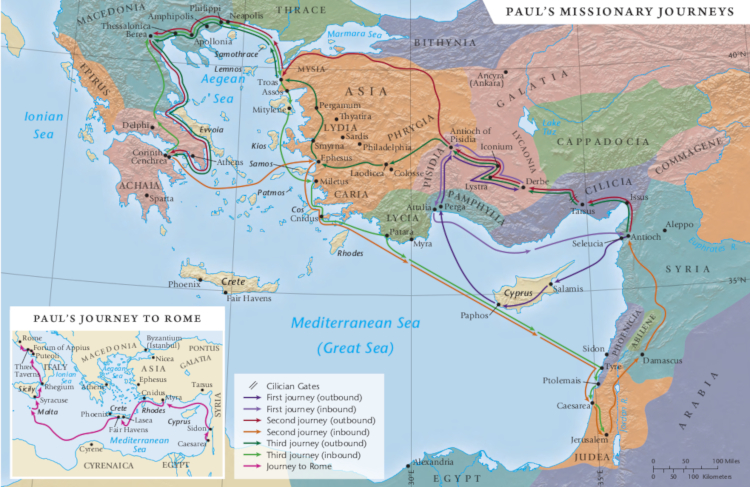
The itinerary of Paul’s three missionary journeys on 1 map and in 1 chart with links to background information on the cities and the reference in Acts.
Above Map from Tyndale
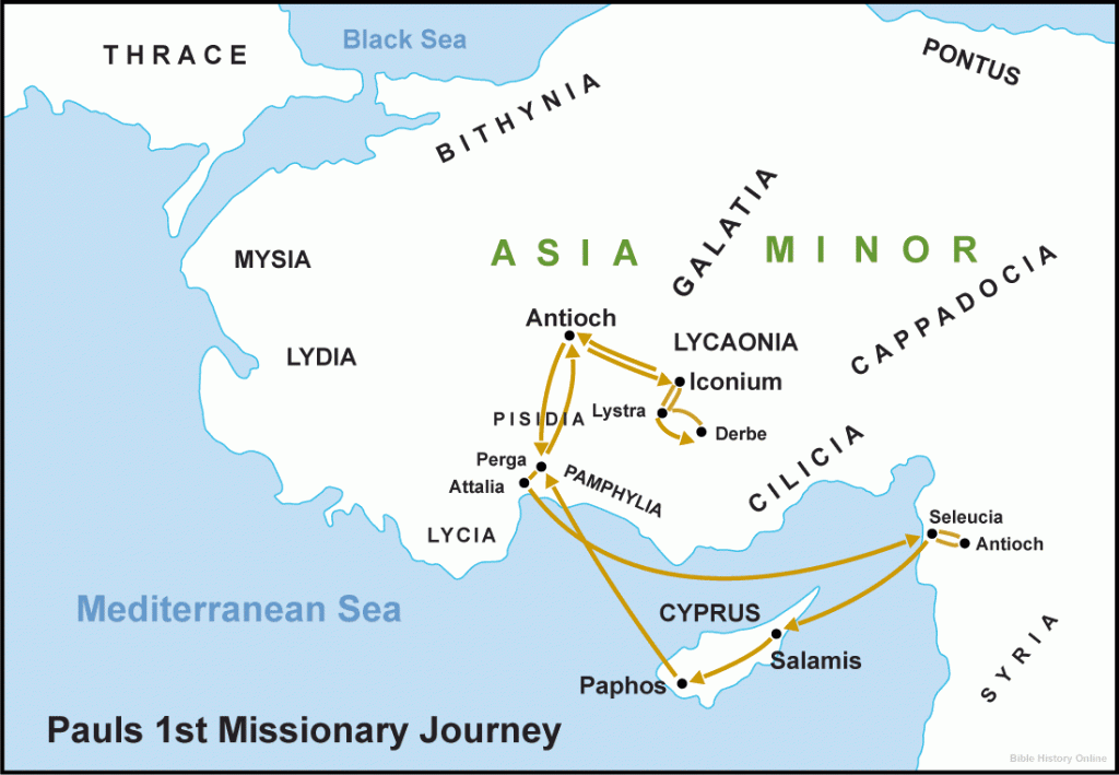
First Missionary Journey

Map from Bible-History Online
- Reference: Acts 13 – Acts 14:28
- Duration: 2 years
- Total miles traveled: 1,235
Holman Bible Atlas: Map of First Journey
Antioch in Syria — Acts 13:1-3
Paphos on Cyprus — Acts 13:6-12
Cities in the region of Southern Galatia:
Perga in Pamphylia — Acts 13:13
Pisidian Antioch — Acts 13:14-50
Back to Home Base:
Antioch in Syria — Acts 14:26
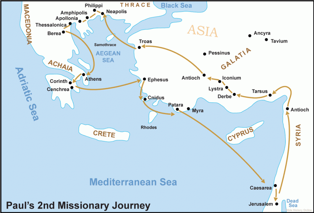
Second Missionary Journey

Map from Bible-History Online
- References: Acts 15:36-Acts 18:23
- Duration: 3 years
- Total miles traveled: 2,703; 1290 by sea and 1,410 by land
Holman Bible Atlas: Map of Second Journey
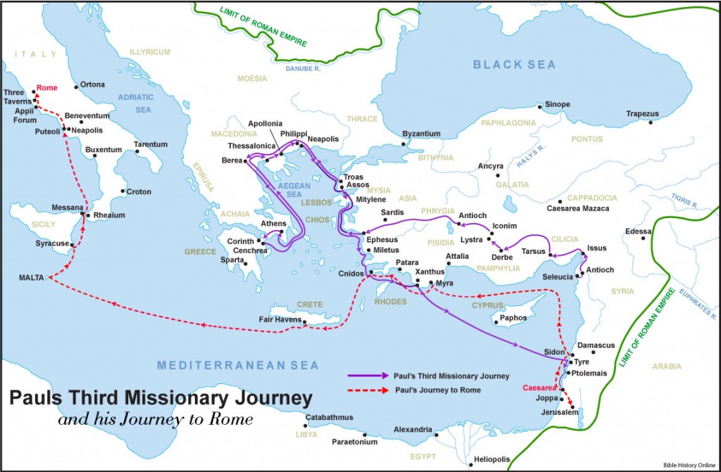
Third Missionary Journey

Map from Bible-History Online
- Reference: Acts 18:23-21:26
- Duration: 4 years
- Total Miles Traveled: 2,515; 1190 by sea and 1325 by land
Holman Bible Atlas: Map of 3rd Journey
Phrygia/Galatia — Acts 18:23-28
Arrest in the temple – Acts 21:16-36
Paul’s Journey to Rome
- References: Acts 21:21-28:31
- Duration 2 years
- Total miles traveled: 2,130 (1920 by sea and 210 by land)
Holman Bible Atlas: Map of Paul’s Journey to Rome

